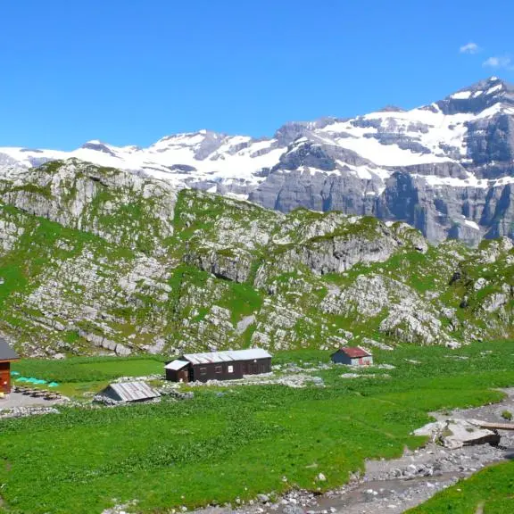
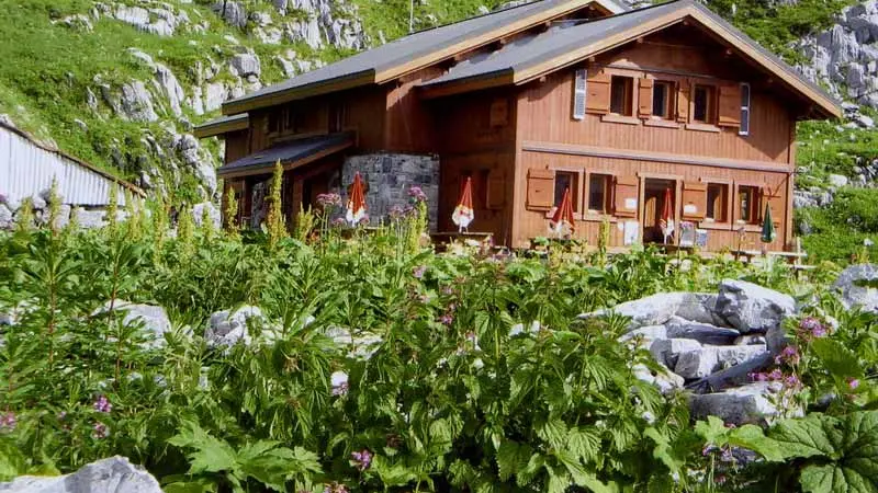
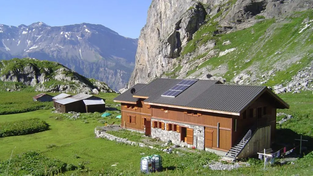
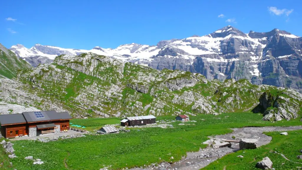
Vogealle mountain refuge

  • Refuge
Elevation : 1901m
Secteur du Cirque du Fer à Cheval, 74740 Sixt-Fer-à-Cheval

Description

Located in the Sixt-Fer-à-Cheval nature reserve, this refuge can be reached in 3-4 hours' walk from the Fer-à-Cheval cirque.
Comfortable and ideally located for star trekking or as a stopover on various alpine and wilderness circuits. telephone: 09 88 28 44 07
  • Tips
    Summits : Le Grand Mont Ruan - Les Dents Blanches occidentales - Les Avoudrues - La Pointe Rousse des Chambres
    Day hike:
    - Le lac (2001 m), 30mn away, at the foot of the dents blanches: great panorama of the Tenneverge peak.
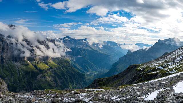
    - Col de Sageroux (2395 m) and Col des Ottans (2500 m): 2h30, border ridge with Switzerland: remarkable view of the Dents du Midi.
    - Petit Ruan (2847 m).
    - La pointe de Bellegarde (2514 m): 2h30.
    Routes :
    Alpine and more technical hikes (requiring suitable equipment): Le Grand Mont Ruan (3057m): 4h.
    Les Avoudrues (2666m) via Pointe de Bellegarde.
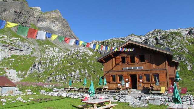
    La pointe rousse des Chambres (2660m) via Pas à l'Ours and Vogealette, over 1 or 2 days via the Folly refuge (for experienced hikers).

Services

Car park
Picnic area

Rates

Access to the parking lot at the Fer-à-Cheval cirque is subject to a charge all the year.
Payment is made via the pay and display machines installed in the parking lots, or in advance via the Presto park application.
Information available from tourist offices.

Payment methods

CheckCheck
CashCash

Capacity

58 Person(s)

Openings

From 13 June 2026 until 26 September 2026 - Open everyday

Location

Vogealle mountain refuge
Elevation : 1901m
Secteur du Cirque du Fer à Cheval, 74740 Sixt-Fer-à-Cheval

Spoken languages

Spoken languages
  • French

Environment

Environment
  • Mountain location

Access

Access
  • The refuge is located on the GR5 variant and on the Via Alpina, on the Tour des Dents Blanches, the Tour du Ruan and the Tour du Haut Giffre.
    Nearest village or station: Sixt Fer à Cheval.
    Access: Take the direction of the Fer à Cheval site (D907).
    After the hamlet of Nambride, park in the spaces provided for this purpose.
    - From the Fer à Cheval car park 3.15 hours via the Pas du Boret (overhead passage equipped with cables and handrails), 4 hours via the Fond de la Combe.
    Coach parking: at Fer à Cheval.
    - Topo guide references: Hiking in the Haut Giffre valley by P. Gain (Edisud)
    - IGN maps: TOP 25 - 3530 ET (Samoëns)
Updated on 21 May 2026 at 11:13
by Haut-Giffre Tourisme
(Offer identifier : 145112)
Filter search
Page types
  • All
  • Articles
  • Agenda
  • Lists