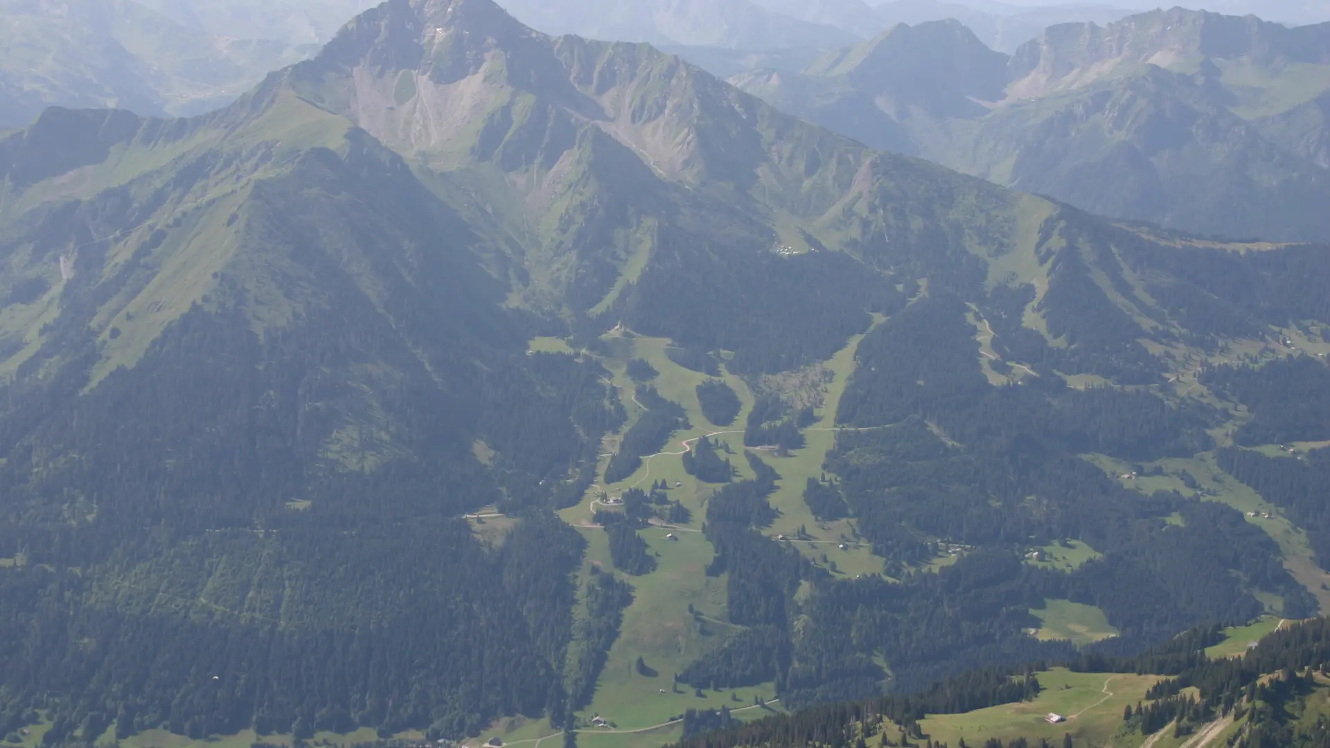
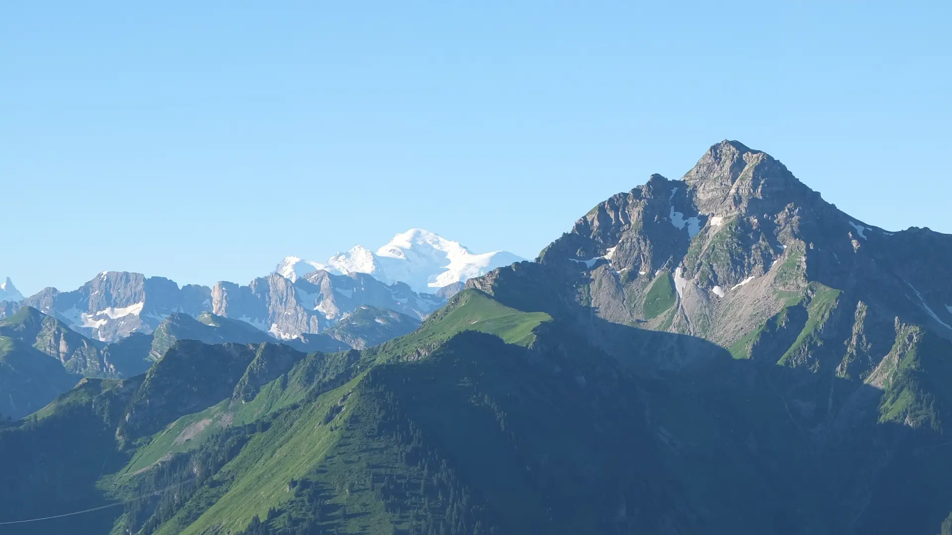
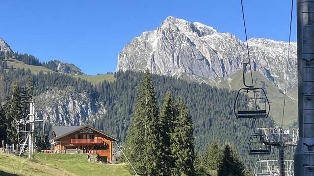
In the heart of the Mont de Grange hunting reserve, you will follow forest paths to reach the Trebentaz refuge. Magnificent views of the Valais and Vaud Swiss Alps await you.
A pretty hike of difficult difficulty in the Mont de Grange reserve, a Natura 2000 reserve and hunting reserve, where 300 hectares of nature are preserved, a refuge for remarkable wildlife: chamois, mouflons, roe deer, stags, wild boar, marmots, golden eagles, capercaillie, etc., and a varied flora with some rare species: alpine columbine, Martagon lily, Paradise lily, bear-eared primrose.
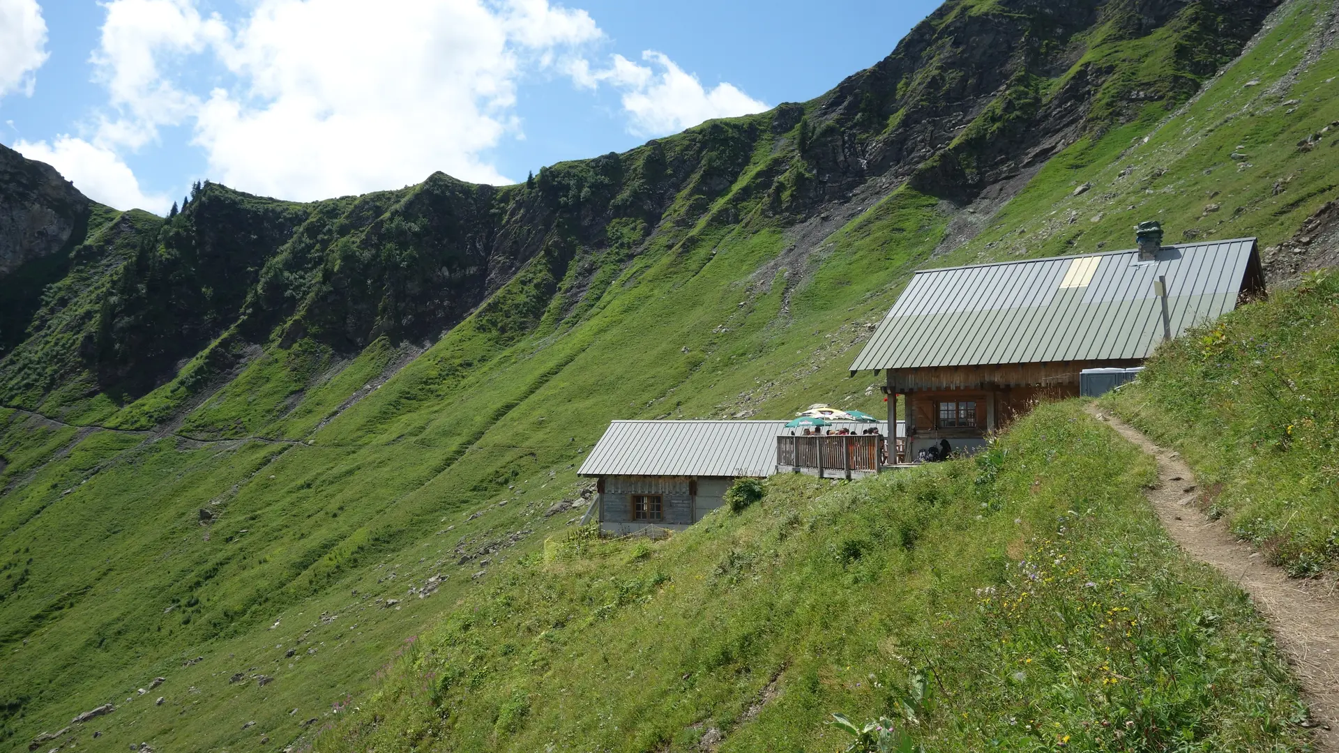
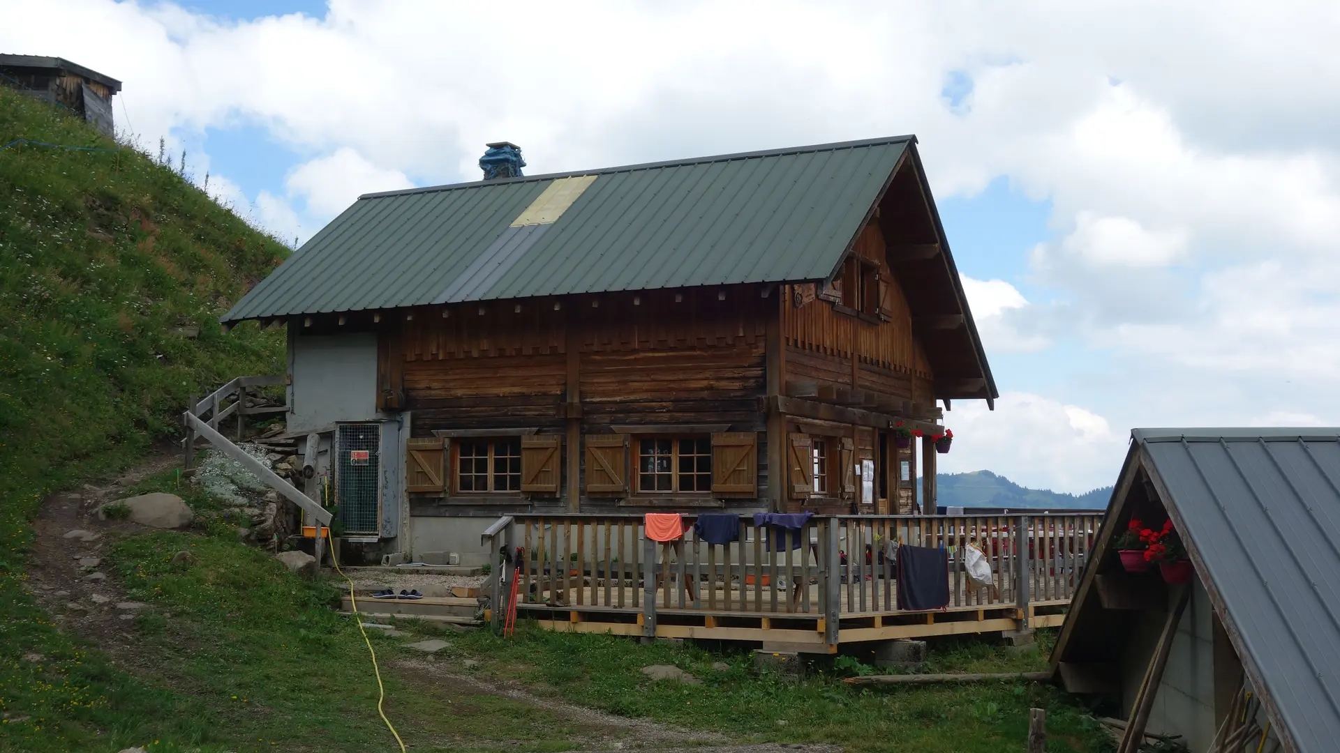
From Plan des Feux, follow the forest track towards Louennaz, then head for the refuge de Trébentaz.
The refuge is a stage on the GR5. You can enjoy an exceptional panorama during a well-deserved lunch break!
From the hut, take a small trail to the "Altitude 2,020 m" sign, the highest point of the route and the best view of the Swiss Alps. The descent is via the Chalets d'alpage du Folliet through a combe. Return in the direction of Plan des Feux.
Departures from the village: you can start the hike from Le Clos or Le Moulin. Count an extra 1h45 walking time.
Whatever your hike, remember to take cereal bars, sufficient water, sunglasses, sun cream, a small first aid kit, as well as clothes adapted to your outing according to the season and the weather forecast.
Read more
Plain text period
From 01/06 to 15/10 daily.
Check with tourist offices in advance to find out the current access conditions.
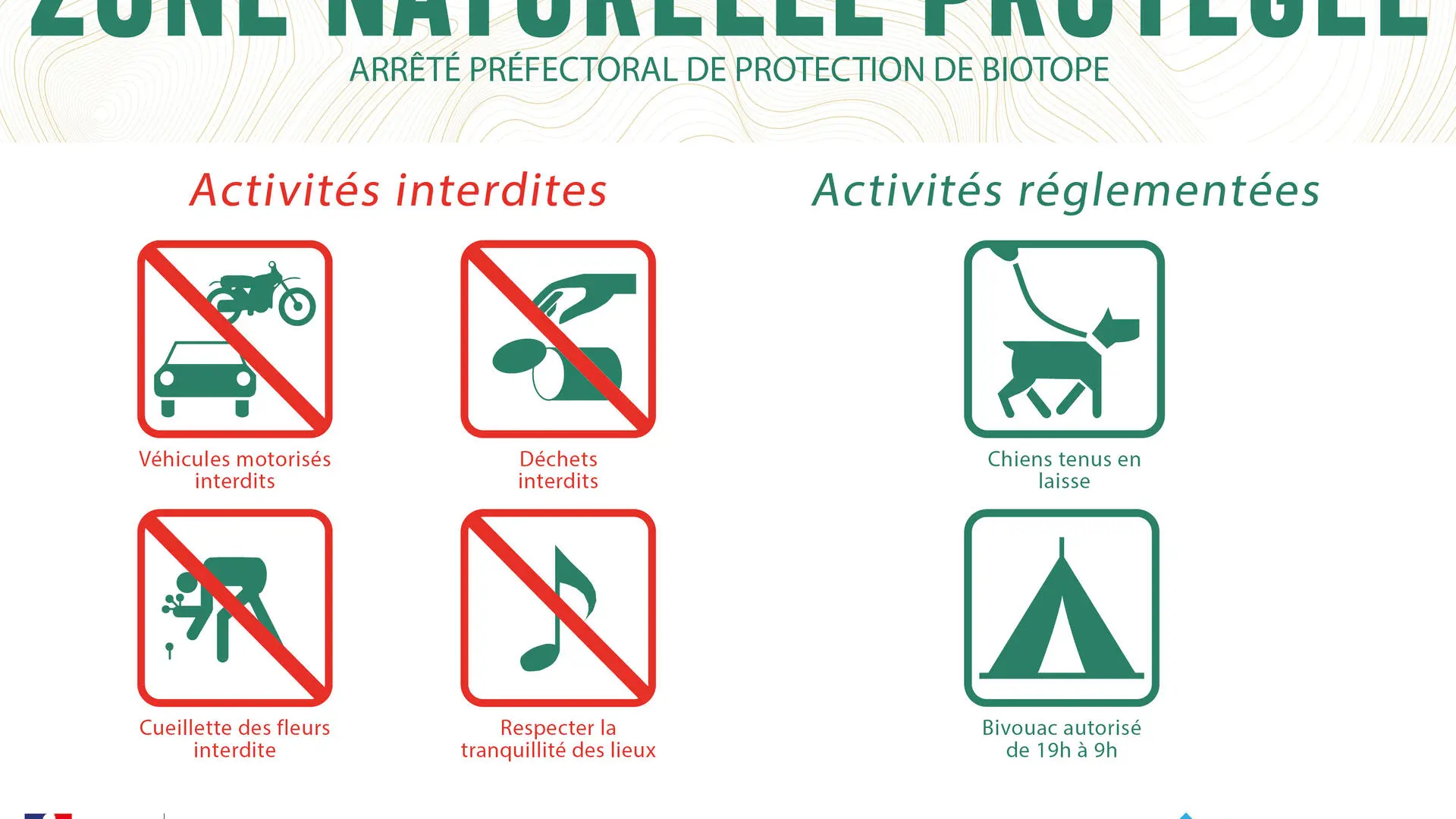
Pets welcome Dogs must be kept on a leash due to the presence of livestock and wildlife.
Livestock guard dogs are present in this area, so it is recommended that you adapt your behaviour to minimise disturbance to the livestock and avoid triggering the dogs (barking, approaching, etc.). If the dogs approach, it is important to let them do so and not try to force your way through.
When approaching the herd:
- Give the herd a wide berth, without putting yourself in danger.
- Walk slowly and dismount from your bicycle.
- Stay together as a group. Speak clearly, without shouting, to make your presence known.
If you encounter the herd:
- Stop: the dogs will come to sniff you to identify you.
- Do not force your way through.
- Do not run away or turn your back on the dogs.
- Do not stare them in the eyes.
- Do not pet the dogs.
- Do not feed the dogs.
- You can hold an object (bag, bicycle, jacket) to put some space between you and the dogs. However, do not use this object to push the dogs away.
- Avoid sudden movements and do not threaten them.
Once the dogs calm down or move away, continue on your way, walking and keeping your distance.
Pet dogs and hunting dogs:
For your safety and theirs, pet dogs and hunting dogs are strongly discouraged near flocks.
In any case, always keep your dog on a lead.
In the event of a conflict,
- let go of the lead,
- do not intervene
- do not pick up your dog.